The UDISE+ GIS & Image Capture Mobile Application is an integral component of the UDISE+ ecosystem, developed by the Department of School Education and Literacy, Ministry of Education, Government of India. This application facilitates the collection of precise GIS coordinates and photographic data of all schools registered under the UDISE+ system across the country.
Designed with a user-friendly interface, the app enables schools, block, district, and state-level education officials to capture accurate location data and upload school images directly from the field. This ensures the creation of a verified, visual, and geographic database of schools nationwide.
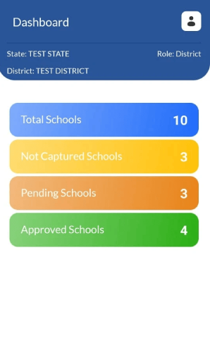
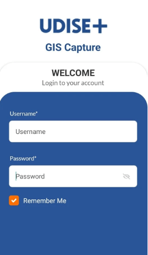
Registered users of UDISE+ can seamlessly log in using their existing credentials, eliminating the need for a separate registration process. Once the location and images are captured by school or block users, they undergo a district-level approval process to ensure data accuracy and authenticity.
The approved GIS data and images are then published for state and national-level review, supporting decision-making, transparency, and integration with various public utility and navigation platforms, ultimately improving access to reliable information about schools across India.